Best Beaches of the Region
From the Blue Lagoon of Ölüdeniz and Iztuzu Turtle Beach to Datça coves and Kaputaş
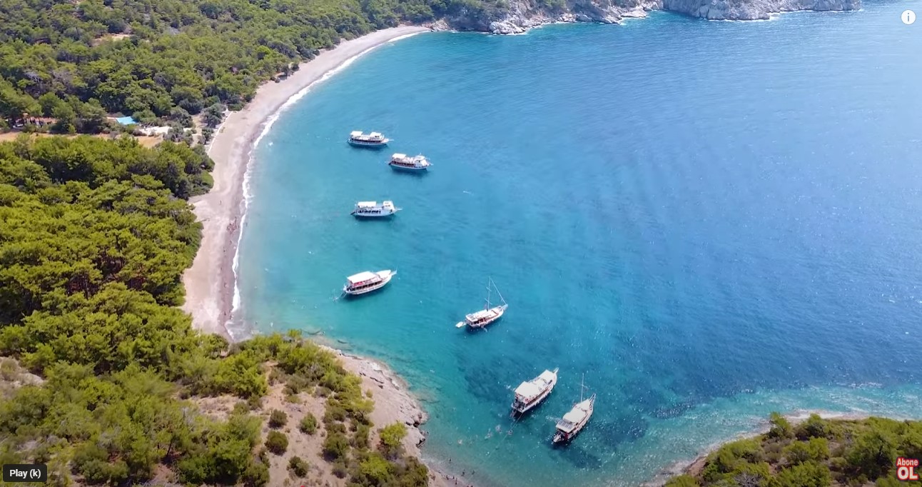
# Domuzbuku Bay (Domuzbükü) — Wild Boar Cove for Secluded Getaways
Domuzbuku is a secluded, wild bay on the Datça Peninsula featuring crystal clear waters, bordered by pine forests and accessible only by sea. Its literal name ("Pig Bay" or "Boar Ravine") comes from the wild boars (domuz) that occasionally descend from the surrounding forests to drink at the local stream. However, for travelers, this cove is synonymous with absolute freedom and a digital detox. Reaching Domuzbuku by land is very difficult, as there are no roads, only challenging sections of the Carian Trail. The only practical way to visit is by water. The bay is a popular anchorage for yachts and Blue Cruises (Mavi Tur) sailing the [Datça](/en/dacha) coast. For years, the bay's icon was a rustic cabin run by Salih, serving woodfired gözleme, but today the beach remains entirely wild. The shoreline is made of large pebbles, and the sea is calm and exceptionally clean. Practical Information Location: Datça Peninsula, Gulf of Gökova, about 12 km by water from [Datça](/en/dacha) harbor Road: Boat only (excursion boats, yachts) or on foot via challenging Carian Trail routes Infrastructure: None (wild pebbly beach, no toilets, showers, or shops) Entrance: Free Tip: Make sure to bring your own water, food, and sun protection. Water shoes are highly recommended due to the large pebbles along the coast.
Read More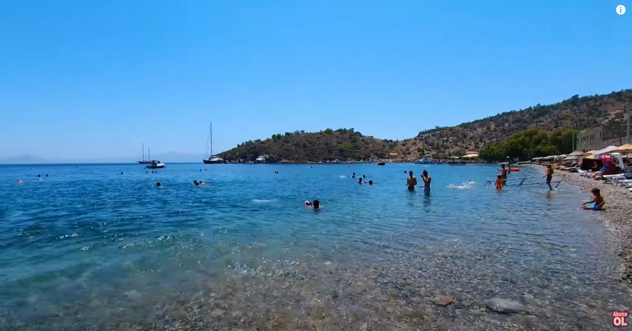
# Kargi Bay (Kargı Koyu) — Picturesque Pebbly Cove near Datça
Kargi Bay is a windsheltered pebbly cove with crystal clear turquoise water, located just three kilometers from the town center of Datça. Surrounded by hills that block the northern winds, the sea here is almost always calm, smooth as a mirror, and slightly warmer than at other open beaches on the peninsula. The shoreline is covered with large, colorful, smooth pebbles, which keep the water incredibly transparent. Several private restaurants and beach clubs operate along the coast, offering sunbed and umbrella rentals alongside Aegean cuisine. A free municipal beach area is also available, complete with changing cabins, showers, and toilets. You can easily reach the bay by car, by a regular minibus (dolmuş) from the center of [Datça](/en/dacha), or by walking along a scenic trail (about 40 minutes). Practical Information Location: Datça Peninsula, 3 km southwest of [Datça](/en/dacha) town center Road: Asphalt road, easily accessible for all types of vehicles Infrastructure: Beach cafes, restaurants, sunbed rentals, municipal changing cabins, toilets, showers, car parking Entrance: Free; car parking and sunbed rentals are paid separately Tip: The beach pebbles are quite large and heat up quickly under the sun, so wear water shoes for a comfortable swim.
Read More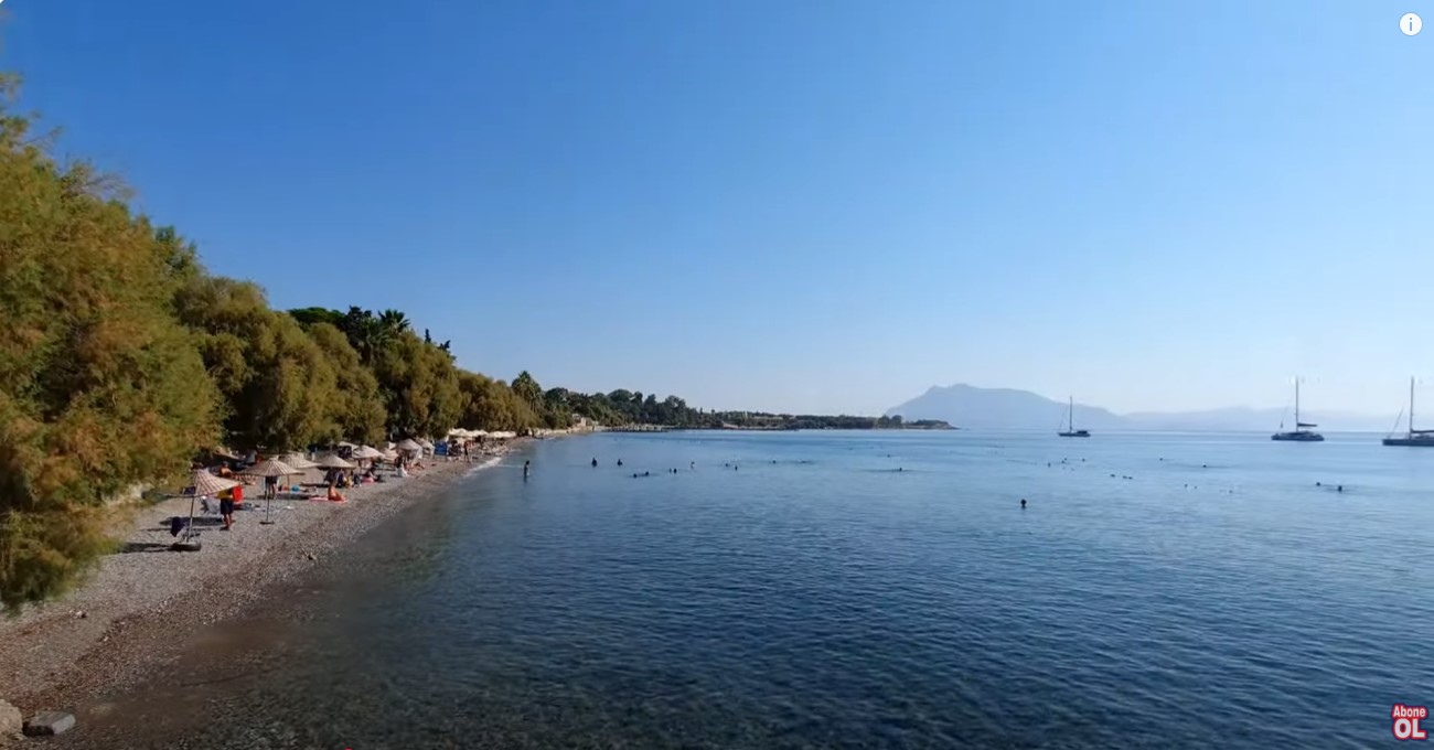
# Kumluk-Strand (Kumluk Plajı) — Das sandige Herz von Datça
Der KumlukStrand ist ein beliebter Sandstrand im Zentrum von Datça, bekannt für sein flaches Wasser und die romantischen Strandrestaurants am Abend. Im Gegensatz zu den meist kiesigen Buchten der Region bietet Kumluk feinen goldenen Sand und ein flaches, ruhiges Meer, was ihn ideal für Familien und Paare macht. Tag und Nachterlebnis Tagsüber ist Kumluk ein klassischer Stadtstrand. Das Wasser ist sehr flach und warm, was optimale Bedingungen für kleine Kinder bietet. Sie können Liegen und Schirme bei den Strandclubs mieten oder sich im freien Bereich aufhalten. Nach Sonnenuntergang verwandelt sich der Strand in ein stimmungsvolles OpenAirRestaurant. Die Tische werden direkt auf den Sand an der Wasserkante gestellt. Ein Abendessen mit den Füßen im warmen Sand und Blick auf die beleuchtete Bucht gehört zu den schönsten Erlebnissen in [Datça](/de/dacha). Praktische Informationen Lage: Zentrum von [Datça](/de/dacha), an der Fußgängerpromenade Sevgi Yolu Anfahrt: Asphaltierte Straßen (zu Fuß oder mit dem Auto leicht erreichbar) Infrastruktur: Umkleidekabinen, Duschen, Toiletten, Verleih von Liegen und Schirmen, zahlreiche Cafés und Restaurants Eintritt: Kostenlos (Miete für Liegen/Schirme und Verzehr in Restaurants kostenpflichtig) Tipp: Besuchen Sie den Strand tagsüber mit Kindern und reservieren Sie für den Abend unbedingt einen Tisch direkt am Wasser.
Read More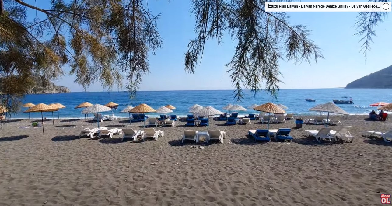
# Ovabükü Beach (Ovabükü) — A Secluded Haven for Peaceful Relaxation
Ovabükü Beach is a tranquil sandandpebble bay on the Datça Peninsula, renowned for its untouched nature, serene atmosphere, and peaceful rural setting. Unlike the busier neighboring Palamutbükü, this wide beach is surrounded by lush green hills, olive groves, and local orchards. It is the perfect destination for travelers seeking solitude, digital detox, and a break from the crowds. Nature and Vibe The shoreline at Ovabükü is relatively wide and long, composed of a mix of sand and smooth pebbles. The water is incredibly clear, showing a beautiful gradient from turquoise to deep blue. As the sea entry can be stony in some areas, water shoes are recommended for a comfortable swim. There are no large, noisy resorts or nightclubs here. The local infrastructure consists of familyrun pensions, quiet campsites, and cozy local taverns (lokantas) serving Aegean dishes made from fresh local ingredients. From Ovabükü, you can easily walk to the adjacent smaller coves of Hayıtbükü and Kızılbük. Practical Information Location: [Datça](/en/dacha) Peninsula, approximately 15–20 km southwest of the town center Road: Asphalt (winding mountain roads). Regular minibuses (dolmuş) operate from Datça center during the summer season. Infrastructure: Familyrun cafes and restaurants, changing cabins, showers, toilets, sunbed and umbrella rentals Entrance: Free (sunbed rental is paid or included with a cafe purchase) Tip: Bring water shoes due to pebbles at the water's edge. The bay is ideal for yoga, reading, and enjoying nature in complete tranquility.
Read More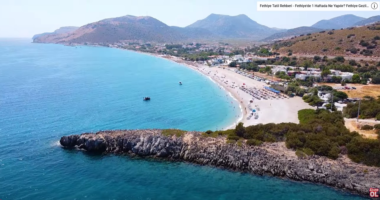
# Palamutbükü Beach (Palamutbükü) — Expansive Turquoise Sea and Scenic Orchards
Palamutbükü Beach is a vast pebble shoreline on the Datça Peninsula, famous for its exceptionally clear turquoise water and surrounding almond orchards. This long coastal strip is widely considered one of the most beautiful and popular destinations on the peninsula. Stretching for nearly two kilometers, the wide beach ensures there is plenty of space for visitors, even during the peak summer months. Beach Features and Amenities The shore is covered in flat, smooth pebbles of small to medium size, mixed with occasional sandy patches. Due to the pebbly bottom, the sea remains crystal clear, offering excellent visibility that makes it highly popular for snorkeling. The water exhibits a striking turquoise hue, and the descent into the sea is relatively gradual, though water shoes are highly recommended. The promenade running along the beach is lined with a variety of accommodation options, including cozy aparthotels and local pensions. There are numerous beachfront cafes and fish restaurants. The bay is named after Atlantic bonito (palamut in Turkish), which you can enjoy fresh at the local seaside taverns. Practical Information Location: [Datça](/en/dacha) Peninsula, about 25–30 km southwest of the town center Road: Asphalt (a scenic route with tight curves). Regular minibuses (dolmuş) run from the center of Datça in summer. Infrastructure: Cafes, fish taverns, changing cabins, showers, toilets, sunbed and umbrella rentals Entrance: Free (sunbed rental is paid or included with food and drink purchases at beachfront restaurants) Tip: Be sure to bring water shoes for an easy entry into the sea and a snorkeling mask to fully enjoy the incredibly clear water.
Read More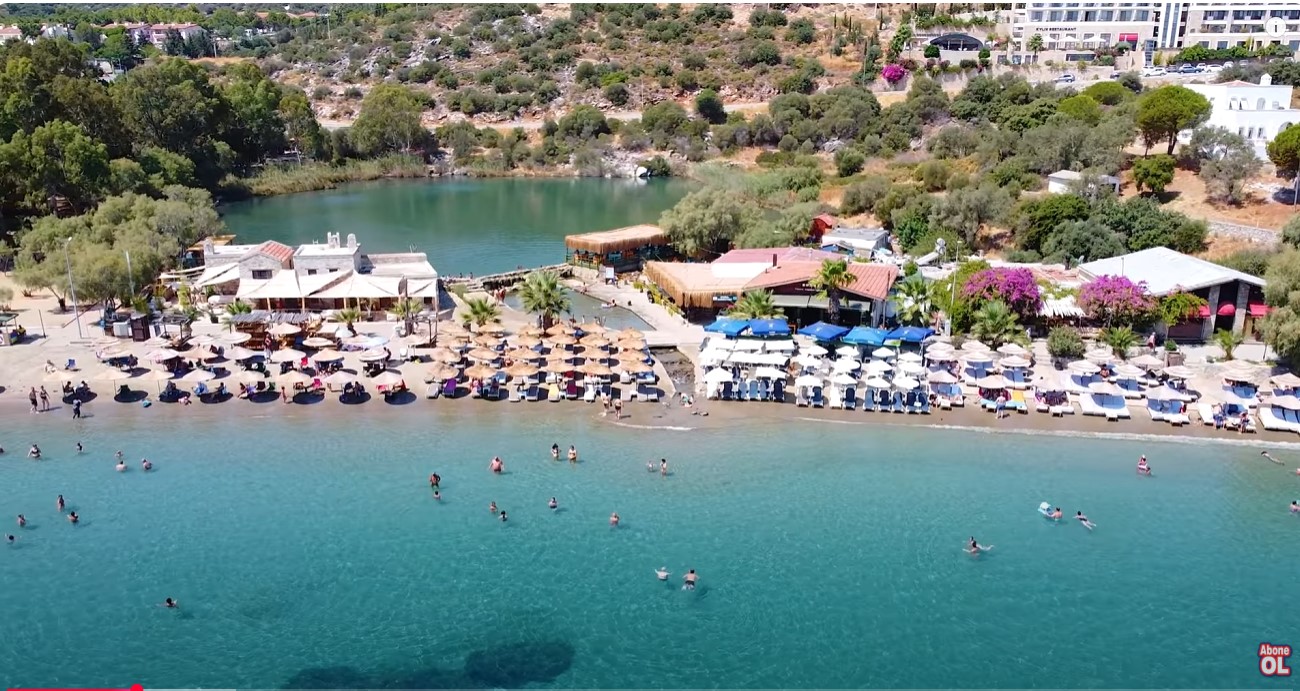
# Taşlık Beach (Taşlık Plajı) — Where the Warm Sea Meets the Cool Mineral Spring
Taşlık Beach is a popular pebbleandsand city beach in Datça, famous for its proximity to the mineralrich, therapeutic waters of the Ilıca Pond. Located within walking distance of the central harbor, this public beach is beloved for a unique natural phenomenon where cool freshwater streams mix with the warm salt waters of the Aegean Sea. Beach Features and the Ilıca Spring The highlight of Taşlık Beach is the small freshwater Ilıca Pond (Ilıca Göleti) sitting just behind the shoreline. Fed by cool underground springs, the pond’s water is slightly mineralized and contains sulfur, giving it a therapeutic reputation. As it flows through the gravel into the sea, it creates refreshing, cool pockets of freshwater within the warm seawater, offering a pleasant contrasting temperature experience. The shore is composed of smooth pebbles of small to medium size, which keeps the water crystal clear. A scenic promenade runs along the beach, leading directly to the harbor and the nearby Kent Park, which offers green spaces and playgrounds for children. Practical Information Location: Central [Datça](/en/dacha), just south of the harbor Road: Asphalt (easily reachable on foot from the town center) Infrastructure: Changing cabins, showers, toilets, sunbed and umbrella rentals, nearby cafes, restaurants, and a park Entrance: Free (sunbed rental is paid) Tip: Take a dip in the natural pool of the Ilıca Pond after swimming in the sea. Wearing water shoes is recommended due to the pebbly shore.
Read More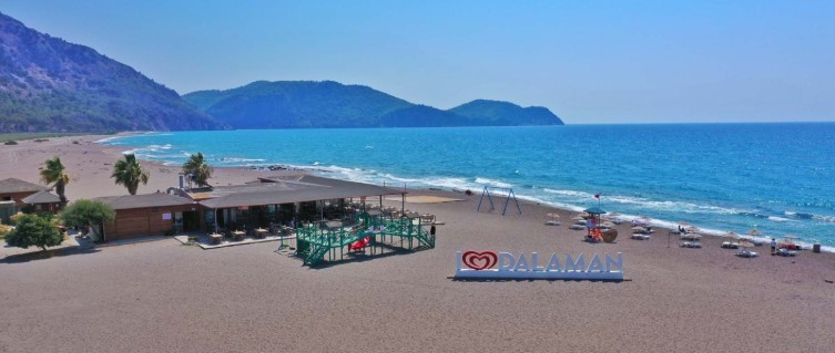
# Kayacik Beach (Kayacık Plajı) — Plane Spotting and Wild Coastal Nature
Kayacik Beach is a spacious municipal beach in Dalaman next to the airport runway, offering fantastic opportunities for plane spotting and scenic sunsets. Beach and Sea The beach is wide and long, consisting of a mix of sand and pebbles. The sea is open and clean, though the lack of a sheltered bay means waves and wind are common. The spot is highly popular with locals, especially in the evening, as it offers a panoramic sunset view. Swings and art installations are set up on the shore for photos. Infrastructure The beach is fully managed by the [Dalaman](/en/dalaman) Municipality (Dalaman Belediyesi). There is a budgetfriendly municipal cafe, along with showers, toilets, and changing cabins. The road from [Dalaman](/en/dalaman) city center is fully paved and suitable for all types of vehicles. Practical Information Location: 10 km from [Dalaman](/en/dalaman) city center (approx. 10 minutes by car). Road: Asphalt. Infrastructure: Municipal cafe, toilets, showers, changing cabins, sunbed and umbrella rentals, playground. Entrance: Free, parking is free. Tip: Visit in the late afternoon to catch the sunset and photograph planes in the evening light. Due to waves and wind, it is not the most suitable choice for families with toddlers.
Read More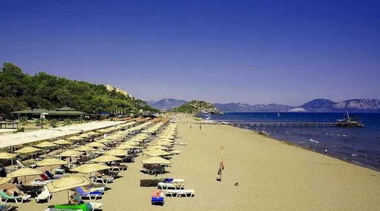
# Sarigerme Beach (Sarıgerme Plajı) — Golden Sands and Perfect Family Getaway
Sarigerme Beach is one of the region's finest sandy beaches with a shallow entry and a Blue Flag, making it an excellent choice for family holidays. Beach Highlights Sarigerme is famous for its multikilometer stretch of fine golden sand. The beach is exceptionally wide, the sea is clean and open, which often brings a refreshing breeze and light waves. The central and most popular part is managed by the SARÇED association. Renowned for its ecological cleanliness and safety, the beach is regularly awarded the prestigious Blue Flag. While major resorts line the coast, the SARÇED municipal area is open to all visitors. Facilities The recreation area is fully equipped with a cafeteria serving snacks and drinks, toilets, showers, changing cabins, lifeguards, playgrounds, and a grassy picnic zone. The road leading to the beach from [Dalaman](/en/dalaman) is completely paved. Practical Information Location: 12 km from Ortaca center, 15 km from [Dalaman](/en/dalaman) airport. Road: Asphalt. Infrastructure: Cafe, toilets, showers, changing cabins, sunbeds and umbrellas, playground, picnic area, lifeguards. Entrance: Paid. A small entry fee is charged for pedestrians and vehicles (approx. 300 TL for car parking). Tip: An ideal spot for families with young children due to the soft sand and shallow shoreline. Bring plenty of sun protection as there is no natural shade on the sand.
Read More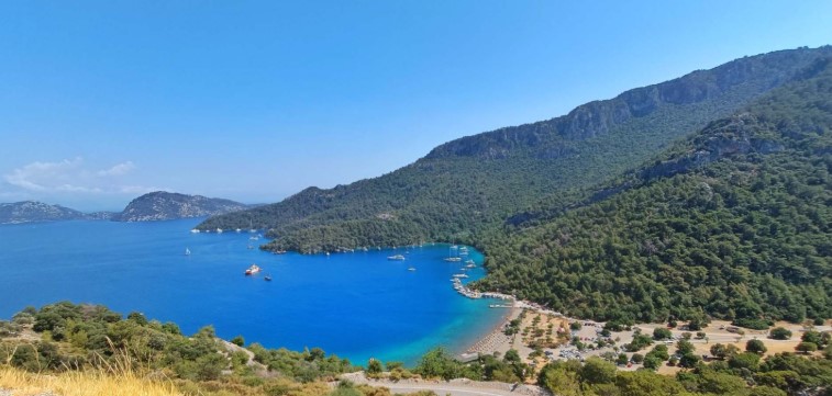
# Sarsala Bay (Sarsala Koyu) — Picturesque Cove Surrounded by Pine Hills
Sarsala Bay is a scenic pebbly cove in Dalaman, surrounded by pinecovered hills, sheltered from waves, and highly popular among yachting enthusiasts. Beach and Bay Features Sarsala Bay is naturally sheltered from strong winds and open seas by lush pinecovered hills. The water is exceptionally clean, calm, and warm, with virtually no large waves, making it perfect for swimming and snorkeling. The shoreline is mostly pebbles mixed with sand, and the depth increases rather quickly. A lifeguard station and beach swings are set up on the shore. On weekends, the beach can become very crowded with local visitors. Amenities and Road The beach is managed by the [Dalaman](/en/dalaman) Municipality, which operates a budgetfriendly cafe onsite. Visitors can use changing cabins, showers, toilets, and rent sunbeds and umbrellas. The road from [Dalaman](/en/dalaman) center is paved, though the final few kilometers turn into a narrow, winding mountain serpentine that requires careful driving. Practical Information Location: 17 km from [Dalaman](/en/dalaman) city center. Road: Asphalt (narrow and winding serpentine at the end). Infrastructure: Municipal cafe, toilets, showers, changing cabins, sunbeds and umbrellas, lifeguard station, parking. Entrance: Paid. A parking/entry fee per vehicle is charged (approx. 150–200 TL per day, covering parking and use of basic facilities). Tip: Wear water shoes as the entrance to the water is pebbly. During the peak summer season, arrive early to secure a parking spot. Note that official camping and lighting open fires or barbecues are strictly prohibited.
Read More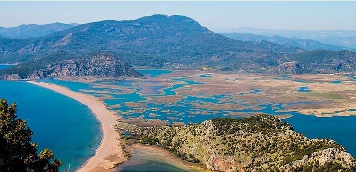
# Iztuzu Turtle Beach (İztuzu Plajı) — A Protected Spit Between Sea and River
The unique Iztuzu Turtle Beach near Dalyan is a 4.5km sandy spit separating the warm Mediterranean Sea and the freshwater delta of the Dalyan River. İztuzu Beach is a unique nature reserve. It is a narrow sandy strip serving as a natural border between the sea and the river delta. The beach's primary treasure is the rare loggerhead sea turtles (Caretta caretta), which have nested here from May to September for centuries. Consequently, strict ecological rules apply: visiting the beach is prohibited at night, pets are not allowed, and nesting sites are protected with metal cages. The beach has two main entrance areas on opposite ends. One (the "road end") is accessible by driving along a scenic road past Lake [Sulungur](/en/dalyan/todo/sulungur). The other (the "boat end") is reachable only by water. The boat end hosts the Sea Turtle Research, Rescue, and Rehabilitation Center (DEKAMER), which is free to visit. Both ends of the beach are equipped with changing cabins, showers, toilets, and municipal cafes. The beach features soft golden sand and a very shallow entry into the water, making it excellent for families. Practical Information Location: 12 km south of Dalyan Road: Asphalt (by car or public dolmuş in about 20 minutes) to the eastern side; or by cooperative public taxiboats from Dalyan harbor through the reed channels of the delta (about 40 minutes) to the western side Infrastructure: Municipal cafes, showers, toilets, changing cabins, lifeguard stations, sunbed and umbrella rentals, DEKAMER turtle rescue center (on the western end) Entrance: Paid (a small environmental fee is charged at the entrance), paid parking. Boatdolmuş tickets are purchased separately Tip: The beach is strictly closed to the public from 20:00 to 08:00. We recommend taking the water taxi to enjoy the scenic boat trip through the delta, and make sure to visit the turtle rescue center.
Read More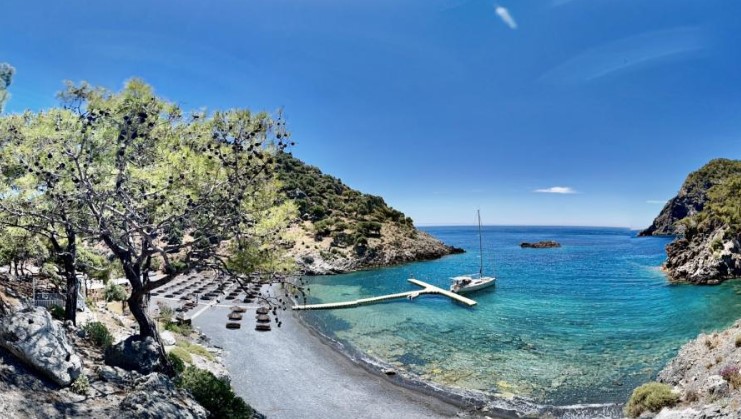
# Asi Bay (Aşı Koyu) — A Secluded Turquoise Paradise Behind Pine Hills
A picturesque and secluded Asi Bay near Dalyan, famous for its turquoise water, a rough dirt road through pine forests, and a zipline over the sea. Aşı Koyu (Asi Bay) is a rewarding destination for adventurous travelers. Hidden among pinecovered hills between Dalyan and Sarıgerme, this bay is wellsheltered from winds and open waves. The shoreline consists of small dark pebbles, which keeps the water crystal clear and gives it a stunning turquoise hue. A small rocky islet sits in the middle of the bay, making it a scenic spot for swimming, cliff jumping, and snorkeling. The beach features a caferestaurant offering sunbed and umbrella rentals, toilets, showers, and changing cabins. A unique highlight of Aşı Koyu is its 150meterlong zipline, suspended about 5 meters above the sea surface, allowing visitors to glide directly over the water. Mobile coverage and internet can be very weak in the valley, so it is highly recommended to bring cash Turkish Lira for payments onsite. Practical Information Location: 20 km south of Dalyan (approx. 4050 minutes drive), 14 km from Sarıgerme Road: Asphalt road to Mergenli village, followed by a steep, narrow, and winding 5 km gravel/dirt road. Driving slowly and carefully is advised Infrastructure: Caferestaurant, toilets, showers, changing cabins, sunbed rentals, picnic area, zipline over the water Entrance: Vehicle entry fee applies (approx. 70 TL per car), pedestrian entry is free. Sunbeds, umbrellas, and zipline rides are paid extra Tip: Bring cash Turkish Lira, as card payment terminals often fail due to poor mobile reception. To avoid crowds, visit on a weekday morning. Water shoes are recommended for walking on the pebbly shore.
Read More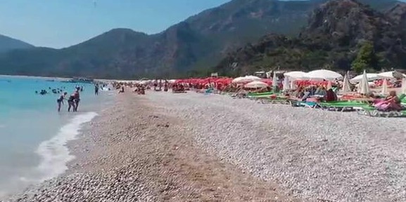
# Belcekiz Beach (Belcekız Plajı) — The Epicenter of Beach Life and Paragliding in Ölüdeniz
A public sand and pebble beach with turquoise water, famous for paragliders landing directly on the promenade after taking off from Mount Babadağ. Belcekız Beach is the heart of daytime activity in the resort of Ölüdeniz. This long and wide coastline serves simultaneously as a place for relaxation, a departure point for boat trips, and the main landing zone for paragliders. On one side, it is bordered by scenic cliffs, and on the other, it transitions into the sandy spit of the famous [Blue Lagoon](/en/fethiye/beach/bluelagoon). The main highlight of the beach is the constant spectacle of landing paragliders. Dozens of pilots and tandem passengers take off from the summit of Mount [Babadağ](/en/fethiye/todo/babadag) and land directly on a designated area of the promenade. You can watch their flight while swimming or sitting in one of the many cafes along the waterfront. The shore is composed of pebbles mixed with sand. The water boasts a stunning turquoise hue, but the sea is open, so the depth increases rapidly and waves often pick up in the afternoon. A welldeveloped promenade runs along the beach, offering key infrastructure: toilets, showers, changing cabins, sunbed rentals, and a wide selection of restaurants and shops. Practical Information Location: Ölüdeniz, 14 km south of [Fethiye](/en/fethiye) Road: Asphalt (easily accessible by car, taxi, or regular dolmuş minibuses from Fethiye) Infrastructure: Showers, toilets, changing cabins, lifeguard post, sunbed and umbrella rentals, cafes, restaurants, water sports Entrance: Free (sunbeds and umbrellas are paid), paid parking is available nearby Tip: Water shoes are highly recommended due to the pebbly shore. Be cautious when swimming with children as the water deepens quickly and waves are common.
Read More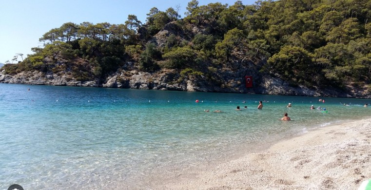
# Blue Lagoon (Mavi Lagün) — Scenic Nature Reserve and the Trademark of Ölüdeniz
The famous sheltered bay featuring turquoise water and the sandy Kumburnu Spit, completely protected from waves and perfect for a peaceful swim. The Blue Lagoon is the signature sight of both Ölüdeniz and Turkey's Turquoise Coast. It is a calm body of water separated from the open sea by the Kumburnu sandy spit. As a result, the lagoon is completely sheltered from big waves, and the water warms up quickly and stays warm longer. The area is protected as a national park (Ölüdeniz Tabiat Parkı), meaning there is an entrance fee. The spit divides the beach area into two distinct sides. The inner shore faces the quiet, shallow waters of the lagoon, making it a perfect natural wading pool for families with toddlers. The outer shore faces the open sea, where the depth increases rapidly and waves roll in, similar to the adjacent [Belcekiz Beach](/en/fethiye/beach/belcekiz). Inside the park, all amenities for a fullday visit are available. There are cafes and restaurants, along with showers, toilets, and changing cabins. Visitors can rent sunbeds and umbrellas, as well as pedal boats or canoes to explore the calm lagoon. The nearby Mount [Babadağ](/en/fethiye/todo/babadag) serves as the launch point for paragliders flying overhead. Practical Information Location: Ölüdeniz, 15 km south of [Fethiye](/en/fethiye) Road: Asphalt (accessible by car, taxi, or dolmuş to the final stop in Ölüdeniz) Infrastructure: Cafes, restaurants, toilets, showers, changing cabins, sunbed and umbrella rentals, pedal boat and canoe rentals Entrance: Paid (pedestrian entry is approx. 150 TL, car entry including parking is approx. 750 TL) Tip: Arrive early in the morning to secure a good spot on the spit and avoid the crowds. Bring a snorkeling mask, as you can spot small fish near the rocky edges of the lagoon.
Read More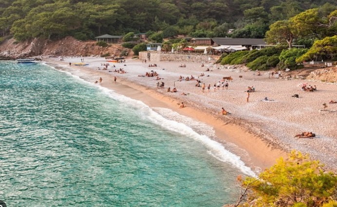
# Kabak Cove (Kabak Koyu) — Secluded Bohemian Oasis and a Haven for Nature Lovers
A wild sand and pebble bay set in a deep canyon, famous for its bohemian atmosphere of freedom, campsites, and the passing Lycian Way trail. Kabak Cove is a unique spot on the Fethiye coast, attracting fans of secluded travel, yoga, and wilderness. Tucked inside a deep canyon surrounded by pine forests, it is completely isolated from the noise of major resorts. There are no large chain hotels here; instead, accommodation is limited to wooden bungalows, yoga retreats, and campsites. The beach is wide, composed of pebbles mixed with sand. The open sea features a deep turquoise color, but the depth increases very quickly and strong waves are common, so swim with caution. A mountain stream flows through the canyon, forming scenic waterfalls deeper in the valley, which can be reached via hiking paths. Getting down to the cove is part of the adventure. By standard car, you can only reach the top of the canyon in the village of Faralya (where paid parking is available). The descent to the beach is a very steep dirt road, accessible only by local 4x4 shuttle trucks or via a steep hike on foot. Practical Information Location: Faralya Village, 30 km south of [Fethiye](/en/fethiye) (approx. 45 minutes by car) Road: Asphalt to the top of the canyon; steep dirt road down to the beach (accessible only on foot or via paid local 4x4 shuttle trucks) Infrastructure: Basic toilets and showers near the beach, sunbeds and umbrellas at private venues, small rustic cafes and bungalows in the pine grove Entrance: Free (parking at the top and the 4x4 shuttle transfer down are paid) Tip: If hiking down, wear sturdy athletic shoes and bring water. Do not attempt to drive down in a rental sedan, as you are highly likely to damage the chassis.
Read More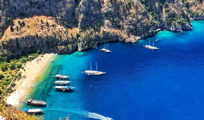
# Butterfly Valley (Kelebekler Vadisi) — The Hidden Canyon and Steep Cliffs of Ölüdeniz
A scenic, deep canyon featuring a pebble beach and waterfall, accessible only by sea and famous for its population of rare Jersey Tiger moths. Butterfly Valley is one of the most recognizable and aweinspiring natural landmarks in Turkey. This deep canyon, wedged between sheer cliffs up to 350 meters high, opens directly to a crystalclear turquoise sea. The entire valley is a protected nature reserve, meaning any permanent construction is strictly banned, preserving its pristine, wild appearance. The valley owes its name to the rare Jersey Tiger moths that inhabit the area. Deeper inside the canyon, reached by a path running alongside a stream, lies a cool, refreshing waterfall. During peak summer, many butterflies can be spotted here, though the influx of visitors has made them more elusive. The beach itself is pebbly, with clear, deep water. Access to the valley is virtually boatonly. Regular shuttle boats (boat dolmuşes) depart from nearby [Ölüdeniz](/en/fethiye), and numerous daily excursion yachts make swimming stops here. While there is a hiking trail descending from the village of Faralya at the top, it is extremely steep, dangerous, and requires climbing skills, making it highly discouraged for general tourists. Practical Information Location: 15 km south of [Fethiye](/en/fethiye) (accessible only by sea from Ölüdeniz) Road: Boat only; the hiking trail down from Faralya is hazardous and not recommended Infrastructure: Ecocampsite (wooden huts and tents), basic showers and toilets, a single rustic cafebar with limited options Entrance: Entry to the valley/waterfall area is paid (approx. 100250 TL, collected by the cooperative for reserve maintenance); boat transfers are charged separately Tip: To experience the silence of this "hidden world," catch the first morning boat or stay overnight at the campsite. Between 11:00 and 16:00, the beach is very crowded with excursion tours. Sturdy shoes are required for the hike to the waterfall.
Read More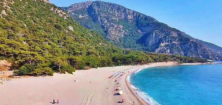
# Kidrak Beach (Kıdrak Koyu) — A Peaceful Pine Haven Neighboring Ölüdeniz
A secluded sand and pebble beach in a nature reserve, bordered by dense pine forests and offering a tranquil escape away from the resort crowds. Kidrak Beach is a hidden gem located just a few kilometers away from the busy [Belcekiz Beach](/en/fethiye/beach/belcekiz) in Ölüdeniz. Set within the Kidrak Natural Park (Kıdrak Tabiat Parkı), it provides a completely different experience — peaceful, slowpaced, and private. There is no loud music or mass tourist groups here; instead, you are surrounded by the sound of waves and singing cicadas. The defining feature of Kidrak is the majestic pine trees growing almost at the water's edge. They offer generous natural shade to hide from the sun and fill the air with a fresh pine aroma. The area behind the beach is set up as a recreational picnic zone (mesire alanı) with tables and BBQ spots, making it a favorite for family gatherings. The shore consists of a mix of sand and clean pebbles. The sea is exceptionally clear and features a beautiful azure color. Unlike the sheltered [Blue Lagoon](/en/fethiye/beach/bluelagoon), this is an open sea coast, meaning the water gets deep quickly and waves can occur. The park has a small cafe, toilets, showers, changing cabins, and sunbed rentals. Practical Information Location: 3 km southeast of Ölüdeniz, 17 km from [Fethiye](/en/fethiye) Road: Asphalt (easily reachable by car, taxi, or the dolmuş heading towards Faralya/Kabak) Infrastructure: Cafe, toilets, showers, changing cabins, sunbed and umbrella rentals, picnic tables, and BBQ zones Entrance: Paid (pedestrian entry is approx. 85 TL, car entry including parking is approx. 255 TL; Museum Card / Müze Kart is not accepted) Tip: Bring water shoes for a more comfortable entry into the sea over the pebbles. If you plan to have a picnic under the pines, it is best to buy your groceries and charcoal beforehand in Fethiye.
Read More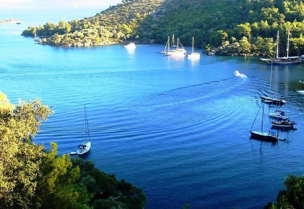
# Bedri Rahmi Bay (Bedri Rahmi Koyu) — Artistic Symbol of Gocek Gulf
Bedri Rahmi Bay is a scenic cove in Gocek accessible only by boat, famous for a unique fish painting on a rock and ancient Lycian rock tombs on the hill. History and Art Historically known as Tasyaka Bay (Taşyaka), it was renamed in honor of the prominent Turkish painter and poet, Bedri Rahmi Eyuboglu. During one of the first "Blue Cruises" in 1974, he painted a fish on a large rock by the shore, inside of which six other fish are secretly depicted. This painting has since become the iconic symbol of yachting cruises in the [Gocek](/en/gocek) area. Nature and Dining The bay is framed by pine forests and olive trees. The beach is pebbly, and the turquoise waters are calm and exceptionally clear. On the hills behind the bay, ancient Lycian rock tombs are visible. The bay has evolved to feature highend dining concepts (like ONNO Grill & Bar and Miori by the Sea) with wooden docks for yachts, toilets, and showers for diners. Direct road access does not exist. Practical Information Location: Gocek Gulf, 10 km (5.5 nautical miles) by water from [Gocek](/en/gocek) harbor. Road: Boat only (excursion boats, private yachts, water taxis). Infrastructure: Wooden piers, upscale restaurants, restrooms and showers at restaurants, wild pebble beach. Entrance: Free (you only pay for transport or boat rental). Tip: Wear sturdy closed shoes (sneakers) to hike up to the Lycian tombs. Bring water shoes due to the pebbly shore and a snorkeling mask to enjoy the crystalclear water.
Read More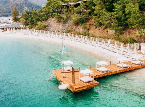
# D-Resort Beach (Blue Point Beach) — Luxury Beach Club with White Sand in Gocek
DResort Beach is the only sandy beach club in the center of Gocek, boasting soft white sand, premium facilities, and firstclass services for guests. Premium Beach Experience This exclusive beach belongs to the fivestar DResort Gocek hotel and is located within the highend DMarin marina complex. The soft, imported white sand does not get hot under the sun. Tucked into a sheltered bay, the sea is always calm, warm, and free of waves. Guests can relax on wide wooden decks with comfortable sunbeds and umbrellas, or book private luxury cabanas for ultimate privacy. The beachfront restaurant and bar, The Breeze, serves fine dining and drinks directly to your sunbed. Access Details For guests staying at DResort Gocek, entry is free, and the hotel provides shuttle service via golf carts. Nonhotel guests can access the beach by purchasing a daily Day Pass at a premium rate. The pass includes the use of a sunbed, umbrella, beach towel, and access to all facilities. Practical Information Location: [Gocek](/en/gocek), DMarin marina area (within walking distance from the town center). Road: Asphalt. Infrastructure: Premium sunbeds, umbrellas, private cabanas, towels, showers, toilets, changing rooms, restaurant and bar (The Breeze), parking. Entrance: Free for DResort Gocek hotel guests; paid for nonresidents (Day Pass at a premium rate). Tip: If you are not staying at the hotel, it is highly recommended to call the hotel reception before visiting. During the peak summer season or days with high hotel occupancy, entry for nonresidents may be restricted.
Read More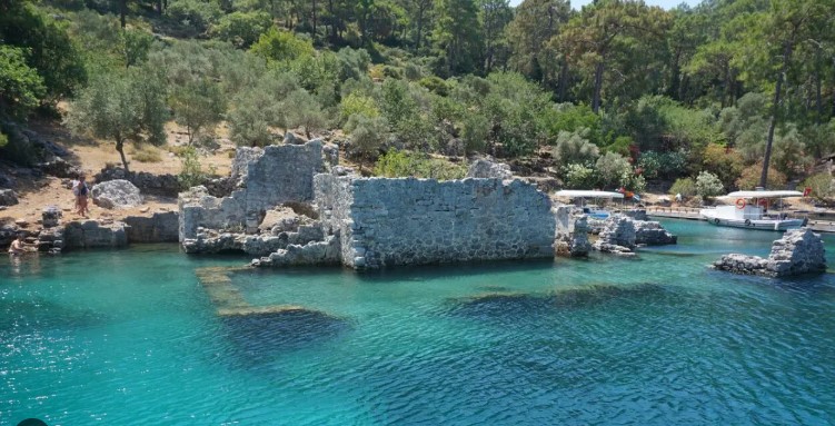
# Cleopatra's Bath (Hamam Koyu) — Legendary Semi-Submerged Byzantine Ruins
Cleopatra's Bath is a unique bay in Göcek with crystal clear turquoise water and sunken Byzantine ruins of ancient baths, accessible only by sea. Also known as Hamam Bay (Hamam Koyu), this picturesque cove is bordered by dense pine forests. According to local legend, these baths were built specifically for the Egyptian Queen Cleopatra during her journey across the Mediterranean. Today, visitors can snorkel directly among the ancient stone walls and arches that have slipped beneath the water. On the shoreline, rustic restaurants (such as Adaia) with wooden jetties serve private yachts and daily excursion boats touring the gulf of [Göcek](/en/gocek). There is no direct road access. You can reach the bay either by water or on foot via a mountainous section of the Lycian Way trail from [Sarsala Cove](/en/dalaman/beach/Sarsala) (about 1.5 to 2 hours hiking one way). Practical Information Location: Gulf of Göcek, 12 km by water from [Göcek](/en/gocek) harbor Road: Boat only (tour boats, yachts, water taxis) or on foot via a rocky Lycian Way trail (approx. 1.5–2 hours) Infrastructure: Small private jetties, shoreline restaurants, restrooms at the restaurants, wild beach Entrance: Free Tip: Wear water shoes while swimming near the ruins, as the underwater stones can be sharp and slippery. Sturdy trekking boots and a good supply of water are essential if you hike the trail from [Sarsala](/en/dalaman/beach/Sarsala).
Read More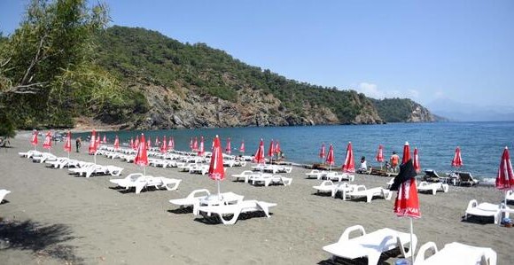
# Inlice Beach (İnlice Plajı) — Spacious Municipal Beach near Göcek
Inlice Beach is a scenic municipal beach with dark volcanic sand and a pine grove, located along the D400 highway just minutes away from Göcek. Since the yachting port of [Göcek](/en/gocek) itself lacks accessible, freetouse beaches within town limits, Inlice serves as the primary public beach for locals and tourists. The coastline is covered with dark volcanic sand mixed with small pebbles near the water. The sea is open and clean, with depth increasing rapidly, and mild waves often develop in the afternoon. The beach is managed by the Fethiye Municipality (Fethiye Belediyesi), ensuring cleanliness and reasonable prices. Amenities include a budgetfriendly municipal cafe, changing cabins, free showers, toilets, and sunbed/umbrella rentals. Directly behind the beach, under the shade of a pine grove, is a designated picnic area (Mesire Alanı). Practical Information Location: 6 km east of [Göcek](/en/gocek) towards [Fethiye](/en/fethiye) (approx. 10 minutes by car) Road: Paved asphalt road D400 with a short access road to the coast Infrastructure: Municipal cafe, toilets, showers, changing cabins, sunbeds and umbrellas for rent, lifeguard station, pineshaded picnic area Entrance: Free for pedestrians; a nominal municipal fee is charged for car parking Tip: The dark sand heats up quickly under the sun, so make sure to bring flipflops or water shoes. Keep an eye on children while swimming, as the water gets deep close to the shore.
Read More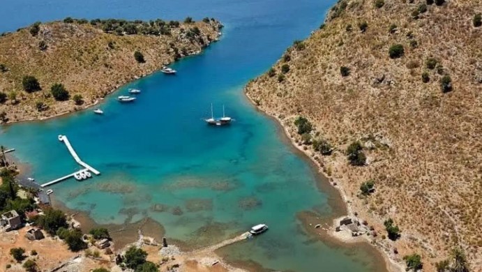
# Tersane Island (Tersane Adası) — Ancient Shipyards and Abandoned Greek Village
Tersane Island is the largest island in the Gulf of Göcek, featuring a rich shipbuilding history, ancient ruins, and abandoned Greek stone houses. Its name (meaning "Shipyard") comes from its historic past: during the Lycian, Byzantine, and Ottoman eras, it was a vital center for building and repairing vessels. Today, the island is a very popular stop for yachts and tour boats sailing the Gulf of [Göcek](/en/gocek). The island is divided into two main coves — Summer Harbor (Yaz Limanı) and Winter Harbor (Kış Limanı). Winter Harbor cuts deep inland and is protected from winds on all sides, historically serving as an ideal shelter for ships. Numerous ruins remain, including shipyard vaults, a watchtower, and abandoned stone houses from a Greek village left in 1923 during the population exchange. In Summer Harbor, a local restaurant operates with its own wooden jetty, serving fresh seafood and spitroasted lamb. There is no land access to the island; it can only be reached by sea. Practical Information Location: Gulf of Göcek, approximately 9 km by water from [Göcek](/en/gocek) harbor Road: Boat only (excursion boats, yachts, water taxis) Infrastructure: Wooden jetty, restaurant, restaurant restroom, wild pebbly beach. No shops or hotels are available on the island Entrance: Free Tip: Wear sturdy closed shoes (like sneakers) to explore the ruins of the abandoned Greek village, as the trails are rocky and overgrown with thorny bushes. Water shoes are useful for swimming because of the pebbly shore.
Read More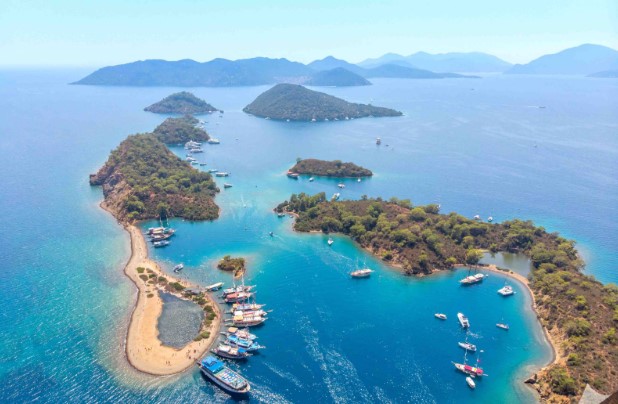
# Yassica Islands (Yassıca Adaları) — Uninhabited Archipelago and Sandy Spits
Yassica Islands are a scenic group of flat, uninhabited islets in the Gulf of Göcek with gentle sandy spits forming a protected shallow lagoon. The archipelago consists of five small islands located very close to each other. The main highlight of this place is a long sandy spit extending into the sea from the largest island. At the tip of this spit, a shallow natural pool is formed, which is ideal for families with children as the water is warm and calm, and the depth increases very gradually. It is possible to wade between some of the islands on foot, and on one of them lies a small natural pond known as the "Devil's Pool". There is no permanent infrastructure on the Yassica Islands; you will not find any toilets, showers, sunbeds, or cafes. All essential amenities are provided on board the visiting yachts. However, during the summer season, local vendors on small boats often anchor nearby to sell traditional Turkish gözleme (pancakes), ice cream, and cold drinks. The islands are accessible by water only. They are a staple stop on the daily boat tours departing from the harbors of [Göcek](/en/gocek) and [Fethiye](/en/fethiye) (such as the popular "12 Islands Tour"), as well as for private yachts and water taxis. Practical Information Location: Gulf of Göcek, 7 km by water from [Göcek](/en/gocek) Road: Boat only (accessible via excursion boats, private yachts, or water taxis) Infrastructure: None (wild islands, temporary food vendors on boats during the season) Entrance: Free (no entry fee to the islands, only boat transfers or tours are paid) Tip: We highly recommend wearing water shoes when walking along the sandy spit and wading between the islands, as there may be sharp stones or sea urchins on the seabed.
Read More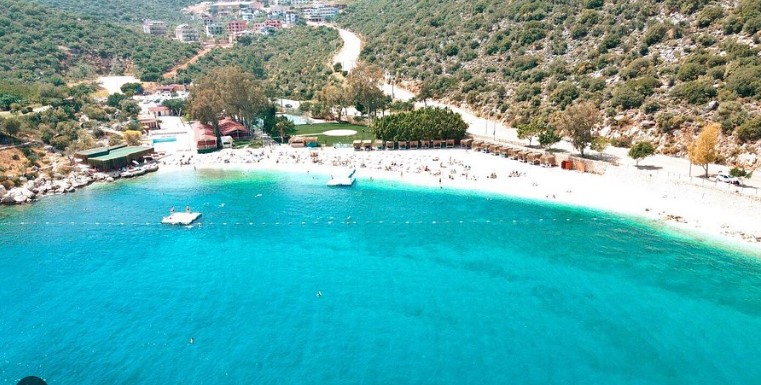
# Akçagerme Beach (Akçagerme Plajı) — Family-Friendly Getaway with a Water Park in Kaş
Akçagerme Beach is a shallow pebble beach located 4 km from Kaş, ideal for families due to its calm waters, water slides, and excellent municipal services. Unlike the typically deep and rocky coves around Kaş, Akçagerme offers a safe and highly organized environment, making it the top choice for travelers with children. Beach Features and StudentRun Service The beach sits in a sheltered bay that keeps the sea calm and free of large waves. The water depth increases very gradually, ensuring a safe swimming experience for young kids. The shoreline is covered in fine pebbles and holds the prestigious Blue Flag award for water cleanliness. A standout feature of Akçagerme is its small onsite water park with waterslides and a dedicated pool. The beach is operated in partnership with the local vocational tourism school. As it serves as a training ground for students, the service is exceptionally polite and attentive, while the prices at the cafe are among the most budgetfriendly in the [Kaş](/en/kas) region. Practical Information Location: [Kaş](/en/kas) region, along the KaşKalkan highway, about 4 km west of the town center Road: Asphalt (directly off the main highway). Regular minibuses (dolmuş) run every 10–15 minutes from the center of Kaş. Infrastructure: Restaurant and cafe, toilets, showers, changing rooms, sunbed and umbrella rentals, children's waterslides, tennis and volleyball courts, wheelchairaccessible ramp, shaded picnic area Entrance: Free (sunbed rentals are paid but reasonably priced; parking is free) Tip: This is the most convenient beach in the Kaş area for families with toddlers. Arrive early during the summer months to secure sunbeds near the shoreline.
Read More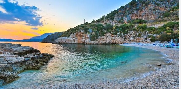
# Büyük Çakıl Beach (Büyük Çakıl Plajı) — Cool Springs and Seaside Dining in Kaş
Büyük Çakıl Beach is a wide pebble bay 1.5 km from Kaş center, famous for its cool freshwater springs and romantic dining experiences right on the shore. Surrounded by lush green hills, this bay is recognized for having some of the clearest waters in the area, offering a more spacious alternative to the central town beach, Küçük Çakıl. Beach Features and Sunset Dinners The hallmark of Büyük Çakıl is the presence of cold underground mountain springs flowing directly into the sea. This creates refreshing pockets of cool freshwater within the warm saltwater, making it a perfect spot to cool down during hot summer days. The beach is composed of smooth, rounded pebbles, and the sea floor drops off relatively fast, leading to deep waters close to the shore. As evening approaches, the beach transforms. The local familyrun restaurants clear the sunbeds and set up dining tables directly on the pebbled shore, just inches from the water. Dining by candlelight under the stars, with the gentle tide washing over the stones, is one of the most romantic and authentic experiences you can enjoy in [Kaş](/en/kas). Practical Information Location: [Kaş](/en/kas) region, eastern edge of the town, about 1.5–2 km from the center Road: Asphalt (a pleasant coastal road). Accessible on foot within 15–20 minutes, by taxi in 5 minutes, or via regular local minibuses (dolmuş) from the center. Infrastructure: Cafes, restaurants, toilets, showers, changing rooms, sunbed and umbrella rentals Entrance: Free (sunbeds are usually included if you order food or drinks from the beachfront cafes, or can be rented separately) Tip: Bring water shoes due to the pebbly entry into the water. If you plan to dine by the water during the busy summer months, booking a table in advance is highly recommended.
Read More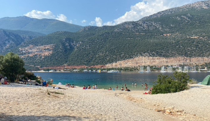
# İnceboğaz Beach (İnceboğaz Plajı) — Swimming in Two Different Seas of Kaş
İnceboğaz Beach is a unique doublesided shore on a narrow isthmus in Kaş, offering visitors a choice between a calm harbor and the open, wavy sea. Located at the narrowest point connecting the Çukurbağ Peninsula to the mainland, this geographic spot lets you choose your swimming conditions by simply crossing the road. The Two Sides of the Isthmus The name İnceboğaz means "thin throat" in Turkish. The road runs along the ridge of the isthmus, separating two completely different beach areas: 1. The Inner Beach (Bucak Bay): Facing the sheltered bay and Kaş Marina, the water here is exceptionally calm, lakelike, and slightly warmer. It is a highly popular and safe spot for families with young children. 2. The Outer Beach: Facing the open Mediterranean Sea and the Greek island of Kastellorizo (Meis). The water here is cooler and more refreshing, with occasional waves on windy days. Both sides feature small pebbles and a relatively gradual entry into the water. The beach holds a Blue Flag certification for its water quality. The inner beach is managed by the local municipality and equipped with basic services, while the outer side is more natural and suited for those who prefer to relax with their own towels. Practical Information Location: [Kaş](/en/kas) region, at the start of the Çukurbağ Peninsula (Çukurbağ Yarımadası), about 1.5 km from the town center Road: Asphalt (easily reachable on foot in 15–20 minutes from the center, or via taxi and local minibuses heading to the peninsula) Infrastructure: Municipal cafe with budgetfriendly food and drinks, changing cabins, showers, toilets, sunbed and umbrella rentals Entrance: Free (sunbed and umbrella rentals are paid; free parking is available along the roadside) Tip: Bring water shoes for a more comfortable walk on the pebbles. If you find one side too windy, simply walk across the road to the other side where it is likely to be calm.
Read More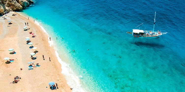
# Kaputaş Beach (Kaputaş Plajı) — Turquoise Gem in a Canyon Ravine
Kaputaş Beach is a worldfamous canyon beach with stunning turquoise water along the D400 road between Kaş and Kalkan, serving as an icon of Turkey. Its postcardperfect scenery is featured in countless travel brochures. Tucked away at the mouth of a steep gorge between towering cliffs, the beach captivates visitors with the contrast of its golden sand and azure sea. Water Features and Natural Charm The secret behind Kaputaş’s intense turquoise shade lies in natural freshwater mountain springs flowing down the canyon and mixing with the sea at the shoreline. This blend of fresh and salt water, combined with the lightcolored sand and fine pebbles on the seabed, creates a striking, photogenic color. The sea water here is fresh and cool, and the depth increases rapidly. Since the beach faces the open sea, waves are a frequent occurrence, providing fun swims but requiring caution. The beach is managed by the local municipality and offers essential services, though it gets highly crowded in July and August. Access and the Famous Stairs To reach the beach from the D400 highway, you must walk down a cliffside staircase of approximately 187 steps. While the descent offers breathtaking photo opportunities, the walk back up in the afternoon heat can be physically demanding. Parking is a major challenge as there is no designated lot; cars line up along the narrow shoulders of the busy highway. Practical Information Location: Lycian coast, D400 highway, about 20 km west of [Kaş](/en/kas) and 7 km east of Kalkan Road: Asphalt highway D400. Taking the local minibus (dolmuş) running between Kaş and Kalkan is highly recommended to avoid severe parking issues, as it drops you off directly at the staircase. Infrastructure: Municipal cafe and snack bar, changing cabins, showers, toilets, sunbed and umbrella rentals Entrance: Free (sunbed and umbrella rentals are paid) Tip: Arrive early in the morning (before 9:30 AM) to secure a parking spot and enjoy the beach before the crowds and heat peak. Exercise extreme caution when walking along the highway.
Read More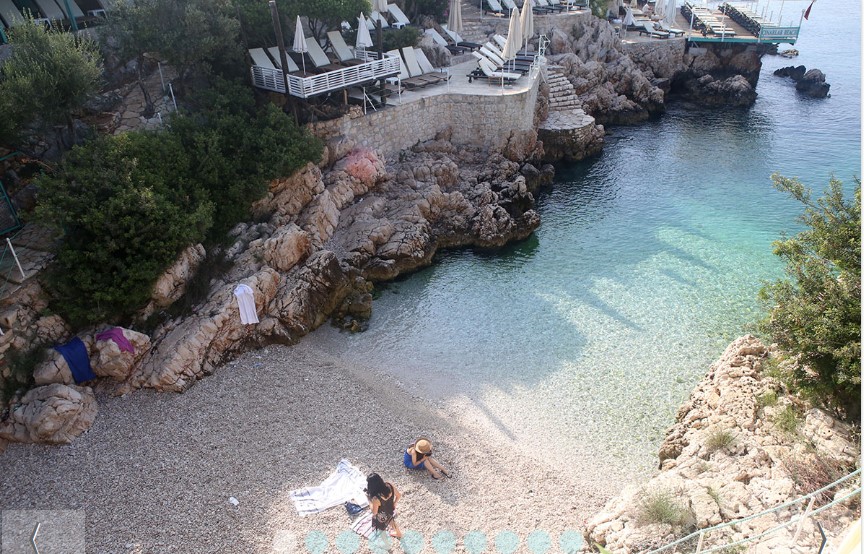
# Küçük Çakıl Beach (Küçük Çakıl Plajı) — An Icy Oasis in the Center of Kaş
Küçük Çakıl Beach is a tiny pebble cove in central Kaş, famous for its icy freshwater springs and trendy beachfront platforms that surround the bay. Located just a short walk from the main town harbor, this small inlet is not meant for long sunbathing sessions, but rather for a quick, incredibly refreshing plunge into crystalclear waters. Beach Features and the Surrounding Beach Clubs The defining characteristic of Küçük Çakıl is the presence of cold freshwater springs bubbling up from the seabed and running down the cliffs. This keeps the water temperature bracingly cool, even during the hottest summer months. Due to the pebbly bottom and the spring water, the sea here boasts an intense emeraldturquoise hue and remarkable transparency. The public pebble strip is very small and has no facilities on its own. Consequently, most visitors prefer to relax at the private beach clubs (such as Derya Beach Club and Çınarlar Beach Club) flanking the cove. These clubs feature wooden platforms built over the rocks, offering sunbeds, umbrellas, ladders into the water, and full restaurant service. Practical Information Location: Central [Kaş](/en/kas), just east of the main harbor Road: Asphalt (easily accessible on foot from anywhere in town, a 5–10 minute walk from Uzun Çarşı) Infrastructure: Beach clubs with sunbeds, umbrellas, dining, showers, and toilets (no facilities are present on the public pebble strip) Entrance: Free for the public pebble area (the adjacent beach clubs are free to enter but operate on a minimum spend deposit for food and drinks) Tip: The cove is not recommended for toddlers due to the cold water, rocky entry, and deep sea. Wearing water shoes is advised, and arriving early is key to securing a spot at the beach clubs in summer.
Read More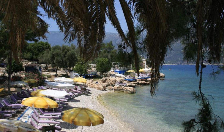
# Limanağzı Bay (Limanağzı) — A Secluded Beach Escape Near Kaş
Limanağzı Bay is a scenic, carfree cove near Kaş accessible only by boat or hiking, famous for its calm sea, sea turtles, and relaxing beach clubs. Because it cannot be reached by road, this sheltered bay offers a quiet environment and remains highly protected from strong winds. Bay Highlights and Beach Clubs Limanağzı is home to several familyrun beach clubs (such as Bilal’s Place, Nuri’s Beach, La Moda Beach, and Delos Beach) scattered along the shore. The clubs feature dining, changing cabins, showers, and sun loungers set up on small pebble shores or custombuilt wooden platforms over the water. The bay is renowned for its calm, crystalclear water. Due to the lack of motor traffic and rich marine life, it is an excellent destination for snorkeling and sea kayaking. Visitors often have the chance to swim alongside Mediterranean monk seals or Loggerhead sea turtles (Caretta Caretta) that frequent the bay. Additionally, because of its unique orientation, Limanağzı gets the longest hours of direct sunlight in the [Kaş](/en/kas) area. Transportation and Access As there is no road for cars, you must park your vehicle in the town center or harbor area in Kaş. Water taxis run regularly every 30 minutes from Kaş Harbor to the bay, taking about 15 minutes to reach the clubs. Alternatively, active travelers can hike to the bay along a scenic section of the Lycian Way starting from Büyük Çakıl Beach, which takes about 1.5 to 2 hours and requires sturdy footwear. Practical Information Location: [Kaş](/en/kas) region, a sheltered bay south of the town, opposite the harbor Road: Boat only (a 15minute water taxi ride from Kaş Harbor) or hiking via the Lycian Way trail (approx. 3 km) Infrastructure: Beach clubs, restaurants, toilets, showers, changing rooms, kayak rentals, sunbed and platform rentals Entrance: Free (the return water taxi ticket costs approximately 200–350 TL. At the beach clubs, you must either rent sunbeds or spend a minimum deposit on food and drinks) Tip: Be sure to bring a snorkeling mask and snorkel to spot the sea turtles. Arrive early to secure the best platform spots and enjoy the longest sunset in Kaş.
Read More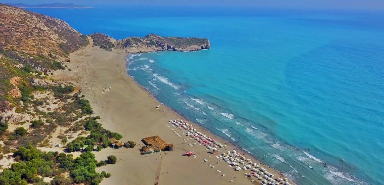
# Patara Beach (Patara Plajı) — Massive Sand Dunes and Sea Turtle Sanctuary
Patara Beach is an epic 18km sandy coastline with desertlike dunes, protected as a Caretta Caretta sea turtle nesting site and part of an ancient city. This endless stretch of soft golden sand, up to 300 meters wide in some areas, forms picturesque dunes that have been used as desert backdrops in cinema. Patara blends archaeological wonders, coastal beauty, and conservation. Natural Attractions and Turtle Protection The main natural highlight of Patara is its rolling sand dunes, which catch the golden light at sunset, offering one of the most stunning sunset walks on the Lycian coast. The sea here faces the open Mediterranean, meaning it is often windy with big waves. The entry into the water is very gradual and sandy, though swimmers should be careful of undertow currents. As a crucial nesting ground for endangered Loggerhead sea turtles (Caretta Caretta), the beach is a strictly protected nature reserve. Between May and September, the beach is closed to visitors from 7:00 PM to 8:00 AM to allow the turtles to lay their eggs undisturbed. Nest sites are marked with protective cages, and sunbeds or umbrellas cannot be placed near them. Access and Facilities The beach is situated near Gelemiş village. Accessing the shoreline requires passing through the [Patara Ruins](/en/kas/ruines/patara) archaeological site, meaning a combined admission ticket must be purchased. There is only one developed area with a municipal cafe, restrooms, changing cabins, and sunbed rentals near the parking lot. Walking just a short distance from the entrance reveals miles of completely wild, untouched beach. Practical Information Location: [Kaş](/en/kas) region, about 43 km west of Kaş town center, near Gelemiş village Road: Asphalt (wellsignposted roads from the D400 highway through Gelemiş). Regular minibuses (dolmuş) run from Kaş bus terminal in summer. Infrastructure: Municipal cafe, restrooms, showers, changing rooms, sunbed and umbrella rentals at the main entrance (the rest of the beach is wild) Entrance: Paid. The combined ticket for the ancient city and the beach costs €15 for foreign tourists (free with Museum Pass Türkiye). Tip: Visit the dunes in the late afternoon to take sunset photos. Because of the constant wind, fine sand can blow into your eyes, so bring sunglasses. Note that the beach closes strictly at 7:00 PM.
Read More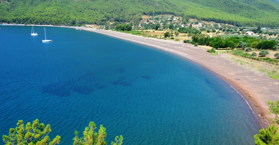
# Ekincik Bay (Ekincik Koyu) — Emerald Yacht Harbor and Quiet Beach
Ekincik Bay is a scenic gulf in Köyceğiz featuring a pebble beach, surrounded by pine forests, highly popular among yachtsmen and seekers of quiet nature. This incredibly beautiful harbor is located approximately 35 km south of the town of [Köyceğiz](/en/koycegiz). Surrounded by steep mountains covered in thick pine forests, the bay is a favorite anchorage for yachts and traditional Turkish gulets sailing the Aegean Sea (as part of the famous "Blue Cruise"). Here, the sea meets untouched wilderness, creating excellent conditions for a tranquil getaway. Beach and Sea The beach is long and composed of dark sand and large pebbles. The water in the bay is exceptionally clear with a deep emeraldblue hue. The water depth increases rather quickly, so parents with small children should remain cautious. During the peak summer heat, the pebbles get very hot, so water shoes are highly recommended for comfortable entry. Infrastructure A wellmaintained municipal beach operates on the coast, featuring a caferestaurant run by the Köyceğiz Municipality. Here you can rent sunbeds and umbrellas, and use the free showers, toilets, and changing cabins. Nearby is a municipal campground for tents and RVs, along with several private pensions. On the eastern slope of the bay sits the famous My Marina restaurant, renowned for its panoramic views of the harbor and fresh seafood. Things to Do Beach Relaxation: Enjoy the pristine sea in a calm and quiet environment. Boat Tours: Rent a small boat to explore local sea caves or sail to the mouth of the [Dalyan](/en/dalyan) River and visit the ancient ruins of [Kaunos](/en/koycegiz/ruine/kaunos). Hiking: Walk along sections of the Lycian Way and forest trails surrounding the bay, which offer spectacular vistas of the gulf. Practical Information Location: Ekincik Bay, 35 km from Köyceğiz. Road: Scenic but narrow and winding paved asphalt road passing through mountain terrain and Hamitköy village. Careful driving is required. Infrastructure: Municipal cafe, toilets, showers, changing cabins, sunbeds/umbrellas for rent, campground, pensions, and restaurants. Entrance: Free. Parking at the municipal lot has a small fee (around 50–100 TL per day). Tip: If you enjoy fresh seafood and stunning viewpoints, book a table at the My Marina restaurant for sunset, but be prepared for prices that are higher than average.
Read More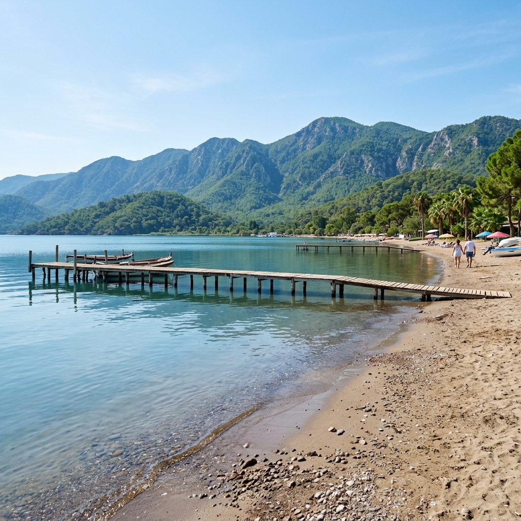
# Lake Beach (Köyceğiz Gölü Plajı) — Mountain-Framed Freshwater Oasis
Köyceğiz Lake Beach is a scenic recreation area with warm fresh water, surrounded by mountains and eucalyptus trees, offering calm swimming without any waves. Lake [Köyceğiz](/en/koycegiz) is a massive tectonic body of water that serves as a wonderful alternative to the classic seaside. The local Lake Beach (Göl Plajı) attracts those looking to cool off in soft, fresh water, away from the salt and bustle of major coastal resorts. Water and Nature Features The lake water is slightly mineralized, as the basin is fed by the famous [Sultaniye Hot Springs](/en/koycegiz/todo/sultanye), which are rich in radon and sulfur. Bathing here is believed to have beneficial effects on the skin and joints. Due to the lack of sea currents and tides, the water is always calm and warms up much faster than the sea. The beach is lined by a picturesque promenade with sprawling palms, majestic eucalyptus trees, and rare sweetgum (liquidambar) trees. Infrastructure The shoreline is equipped with changing cabins, showers, and toilets. Visitors can rent sunbeds and umbrellas. Cozy tea gardens (Çay Bahçesi) and small cafes operate nearby, offering very affordable Turkish tea and snacks accompanied by lovely lake views. Things to Do Water Sports: Rent paddleboards (SUP), kayaks, and pedal boats right on the beach. Walking: Stroll along the shaded [Köyceğiz Seafront](/en/koycegiz/todo/seafront). Sunset Watching: Sunsets over Lake Köyceğiz are considered among the most beautiful on the coast — the sun slowly dips behind the mountain silhouettes, painting the water in gold and crimson shades. Practical Information Location: Along the town waterfront, within easy walking distance from Köyceğiz town center. Road: Flat, paved town street, easily accessible on foot, by bicycle, or by car. Infrastructure: Changing cabins, showers, toilets, sunbed rentals, watercraft rentals, cafes, and tea gardens. Entrance: Free. Town parking along the seafront is free or costs a nominal fee. Tip: During summer evenings, midges and mosquitoes tend to gather near the water, so bring a quality insect repellent for sunset walks.
Read More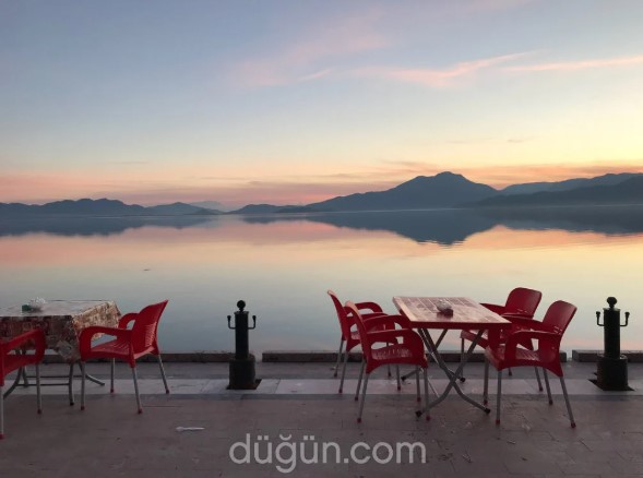
# Delta Beach (Delta Plajı) — Municipal Family Beach in Köyceğiz
Delta Beach is a cozy municipal beach on Köyceğiz Lake, offering a safe shallow entrance, a shaded eucalyptus picnic grove, and an affordable family cafe. This popular beach is located in the southern part of [Köyceğiz](/en/koycegiz) town, right where the scenic eucalyptus [seafront](/en/koycegiz/todo/seafront) ends. Being a municipal facility, Delta Beach is a favorite getaway spot for both local families and tourists traveling with children. Safety and Conditions for Children The main highlight of the beach is its exceptionally gentle, sandy lake bed. Shallow water extends for dozens of meters from the shore, meaning the water is always warm and completely free of waves. This creates an absolutely safe environment for toddlers to splash around. The beach strip consists of a mix of soft sand and fine gravel. Infrastructure and Amenities The beach provides all the necessary amenities for a comfortable day out at very budgetfriendly municipal rates: Municipal Cafe: Serves tea, coffee, cold drinks, ice cream, and light snacks at regulated public prices. Sunbeds and Umbrellas: Available for rent for the entire day for a very modest fee. Picnic Area: Under the shade of tall eucalyptus trees next to the beach, there is a dedicated picnic zone with wooden tables and benches. Campground: A secure municipal campground for caravans and tents is located right next to the beach. Practical Information Location: Southern end of the Köyceğiz seafront, within town limits. Road: Paved town streets. Easily reachable on foot from the town center or by car. Infrastructure: Cafe, toilets, showers, changing cabins, sunbed/umbrella rentals, picnic tables, campground. Entrance: Free. Parking on adjacent streets is free. Tip: The beach gets quite crowded on weekends with local families. For a quieter atmosphere, plan your visit for weekdays or during the morning hours.
Read More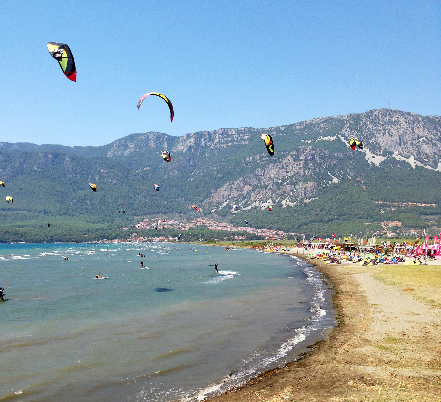
# Akyaka Beach (Akyaka Plajı) — Kitesurfing Hub and the Icy Azmak River
Akyaka Beach is a spacious sandy coastline in the Gulf of Gökova, famous worldwide as a premier kitesurfing destination and for the icy Azmak River. Situated at the head of the scenic Gulf of Gökova, this resort village attracts water sports enthusiasts, nature lovers, and families seeking a unique coastal getaway. Public Beach and the Kite Zone Akyaka's coastline features two distinct sections: 1. Akyaka Public Beach (Akyaka Halk Plajı): A sandy beach with exceptionally shallow and calm waters stretching far out, making it safe and highly popular for families with young children. 2. Akyaka Kite Beach: Located slightly east of the town. Strong, steady thermal winds blow daily from May to October, combined with sandy shallows, making it one of the safest and best spots in Europe to learn and practice kitesurfing. Numerous kite schools and rental shops line the shore. A major natural attraction is the cold, springfed Azmak River (Azmak Nehri), which runs along the town and empties into the sea. The river water is crystal clear and remains a chilly +8–10°C yearround. Diving into the icy river after swimming in the warm sea is a popular local tradition. Boat trips along the river offer views of a vibrant underwater habitat. Practical Information Location: Ula district, about 30 km north of [Marmaris](/en/marmaris), in the Gulf of Gökova Road: Asphalt (accessible via a winding but wellmaintained mountain road from Marmaris). Frequent minibuses (dolmuş) connect Marmaris and Akyaka. Infrastructure: The public beach has sunbeds, umbrellas, showers, changing cabins, toilets, and nearby cafes. The kite beach has training schools, equipment rentals, showers, and bars. Entrance: Free entry to the public beach (sunbeds and umbrellas are paid). The dedicated Kite Beach may charge an entrance fee to cover facility maintenance for nonstudents. Tip: Take a scenic boat tour on the Azmak River to view the "natural aquarium" at the riverbed, followed by a meal at one of the riverside restaurants built on wooden decks directly over the flowing water.
Read More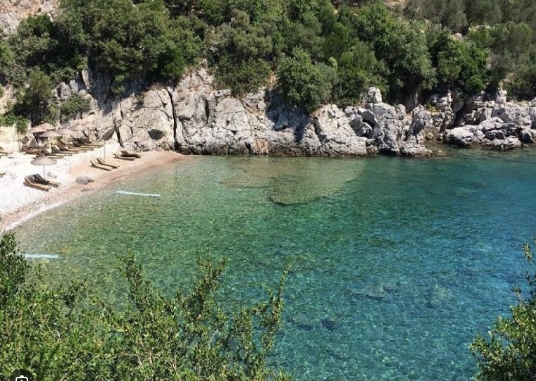
# Amos Bay (Amos Koyu) — Secluded Beach and Ancient Ruins Above the Sea
Amos Bay is a quiet pebble cove with crystalclear waters, topped by the scenic, freetovisit ruins of the ancient LycianRhodian city of Amos. It is an ideal destination for travelers who want to combine a relaxing beach day in a picturesque bay with a historical hike. Ancient City on the Hill and the Beach The main attraction of Amos is the archaeological site situated on a high headland overlooking the bay. The highlight is the ancient theater, which once sat about 1,300 spectators. Sitting on its stone steps under the shade of pine trees and listening to the cicadas, you can enjoy a breathtaking panoramic view of the bay and the open Mediterranean. The remains of Hellenistic city walls and the ancient necropolis are also visible on the hill. The beach itself is small and covered in fine pebbles. The sea here is exceptionally clear with a beautiful turquoise hue, making it a fantastic spot for snorkeling. There is no loud music or water sports, preserving a quiet, laidback atmosphere. Practical Information Location: Bozburun Peninsula, about 24 km south of [Marmaris](/en/marmaris) and 4 km from Turunç village Road: Asphalt (narrow, winding mountain roads from Marmaris via Içmeler and Turunç). A small parking area is available near the ruins entrance. Alternatively, you can walk 30–40 minutes from Turunç or take a taxi. Infrastructure: The beach features the Amos Restaurant, which offers sunbed and umbrella rentals, restrooms, and showers. There are no facilities at the ancient ruins. Entrance: Free (no admission fee for either the beach or the ancient city ruins) Tip: Wear sturdy walking shoes or sneakers to climb the steep, rocky path to the theater. Bring drinking water and sun protection, as there is very little shade at the archaeological site.
Read More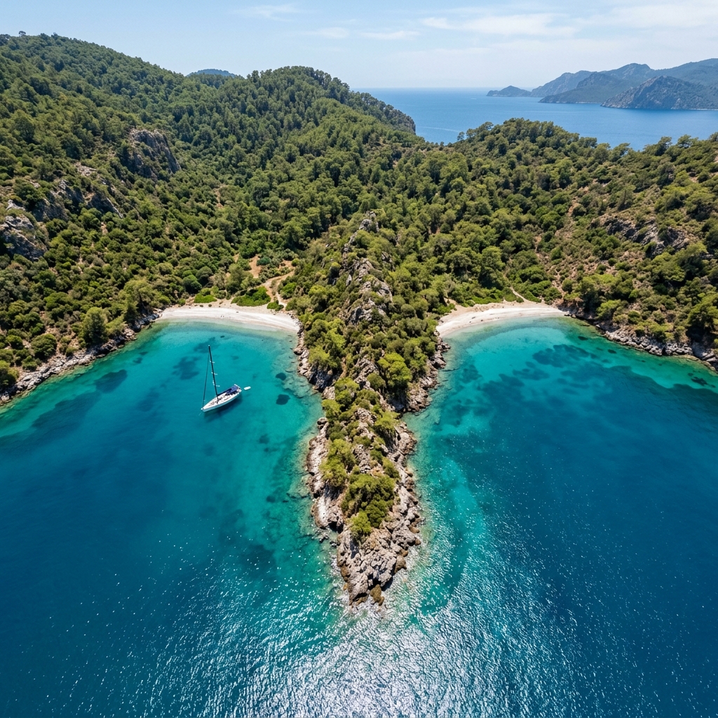
# Çiftebük Bay (Çiftebük Koyu) — A Wild Beach on the Bozburun Peninsula
Çiftebük Bay is a wild, twincove bay on the Bozburun Peninsula, famous for its untouched nature, turquoise waters, and complete lack of road access. Tucked away from mainstream tourism, this hidden gem consists of two symmetrical coves divided by a narrow rocky spit, attracting yacht travelers seeking ultimate privacy. Untouched Nature and Isolation Çiftebük is the epitome of a secret beach. There are no roads leading here, and reaching it by land involves hiking along steep, challenging mountain paths that require proper trekking footwear and a good level of fitness. The primary way to visit the bay is by sea, either on a private yacht charter or via boat tours departing from nearby villages like Bozburun, Söğüt, or Selimiye. The shoreline is made of small and large pebbles, so water shoes are recommended. The sea is crystal clear, calm, and has a deep turquoise color, offering excellent conditions for snorkeling. The surrounding hills are covered with pine forests and wild olive trees, filling the air with a fresh herbal scent. There are no facilities of any kind on the beach. Practical Information Location: Bozburun Peninsula, [Marmaris](/en/marmaris) district, between Bozburun and Söğüt villages Road: Boat access only (yachts, speedboats) or via challenging wild hiking trails. No road access for cars. Infrastructure: None (wild beach). No cafes, toilets, fresh water, sunbeds, or reliable mobile reception. Entrance: Free Tip: If hiking to the bay, bring plenty of drinking water, snacks, sunscreen, and wear sturdy hiking boots. If arriving by boat, use water shoes to comfortably walk on the pebbly shore. Please pack out all your trash.
Read More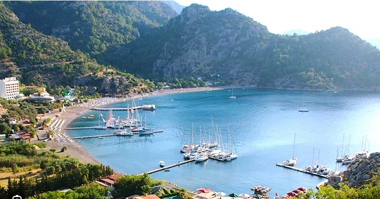
# Çiftlik Bay (Çiftlik Koyu) — A Peaceful Haven with Coarse Sand in Marmaris
Çiftlik Bay is a picturesque sandypebble cove with a private islet, located about 30 km south of Marmaris near the mountain village of Bayır. It attracts visitors with its exceptionally crystalclear waters, a bay sheltered from opensea winds, and a relaxed atmosphere away from city life. Coarse Sand, Islet, and Infrastructure The defining feature of Çiftlik is its beach surface. Unlike most of the rocky coves on the Bozburun Peninsula, the shore is covered in coarse, granular sand with a reddishyellow tint. The sea in the bay is almost always calm and transparent because a small, private island (Çiftlik Island / Çiftlik Adası) sits at the mouth of the bay, acting as a natural breakwater against opensea waves. Several boutique hotels and seafood restaurants (such as Azmak, Mehmet's Place, and Pilos) line the shore, featuring wooden jetties that welcome private yachts. The bay is a favorite stop for yachtsmen and daily cruise boats from Marmaris. In the late afternoon, the crowds disperse, leaving the bay quiet and serene. The rocky edges of the bay are excellent for snorkeling, and the nearby wild Gebekse Bay houses ruins of an ancient Byzantine church. Practical Information Location: Bozburun Peninsula, about 30 km south of [Marmaris](/en/marmaris), past the mountain village of Bayır Road: Asphalt (paved road via Içmeler and Bayır). The final descent to the bay is a steep mountain road with sharp bends that requires cautious driving. Public transport is limited, so driving or taking a taxi is recommended. Infrastructure: Beach restaurants, cafes, minimarkets, and boutique hotels. Sunbeds, umbrellas, changing cabins, toilets, and showers are provided by the beachfront venues (free for diners or for a fee). Entrance: Free (public access to the beach is open to all). Sunbed rental or restaurant parking may require a charge or purchase. Tip: Spend a full day here. Rent a small motorboat to visit the nearby wild Gebekse Bay in the morning, and enjoy a seafood dinner on one of the wooden piers over the water at sunset.
Read More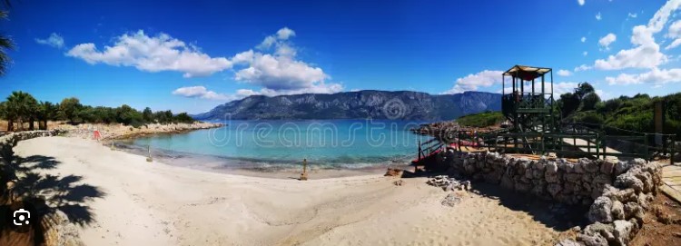
# Insel Sedir (Sedir Adası) — Kleopatra-Strand und Ruinen von Kedrai
Die Insel Sedir (KleopatraInsel) im Golf von Gökova ist berühmt für ihren seltenen oolithischen Sand und die Ruinen der antiken Karerstadt Kedrai. Diese unter Naturschutz stehende archäologische Stätte lockt mit türkisblauem Wasser und der Legende, dass Marcus Antonius den Sand aus Ägypten für Kleopatra herbeischaffen ließ. Perlensand und das antike Kedrai Die größte Attraktion der Insel Sedir ist der KleopatraStrand. Sein goldener Sand besteht aus winzigen, kugeligen OolithKörnern, die an Miniaturperlen erinnern. Dieser seltene Sand heizt sich in der Sonne nicht auf und hält das Wasser absolut klar. Er steht unter strengem Schutz: Es ist verboten, den Sand mit Schuhen zu betreten, Handtücher daraufzulegen oder Sand mitzunehmen (Duschen am Ausgang dienen dem Abspülen). Neben dem Strand beherbergt die Insel die Ruinen des antiken Kedrai. Holzstege führen Besucher durch den archäologischen Park zu einem gut erhaltenen antiken Theater mit Meerblick, Überresten der hellenistischen Stadtmauern, der Agora, dem ApollonTempel und einer byzantinischen Basilika. Praktische Informationen Lage: Golf von Gökova, ca. 23 km nördlich von [Marmaris](/de/marmaris), nahe dem Dorf Çamlı Anfahrt: Nur per Boot. Sie können mit dem Auto über eine asphaltierte Straße zum Hafen Çamlı (Çamlı İskelesi) fahren und dort ein Shuttleboot nehmen (ca. 20 Minuten Fahrt). Alternativ bieten sich Tagestouren ab Marmaris oder Akyaka an. Infrastruktur: WCs, Umkleidekabinen, Duschen und ein staatliches Café sind vorhanden. Liegen und Schirme befinden sich auf Holzplattformen neben dem geschützten Sandstrand. Eintritt: Kostenpflichtig. Der Eintritt zur Ausgrabungsstätte beträgt ca. €13 (kostenlos mit dem Museum Pass Türkiye). Die Überfahrt von Çamlı wird extra bezahlt. Tipp: Wenn Sie eine Bootstour ab Marmaris buchen, prüfen Sie, ob der Eintritt zur Insel inklusive ist. Kommen Sie am besten morgens um 9:00 Uhr mit dem ersten Boot, um den Strand vor den großen Ausflugsschiffen zu genießen.
Read More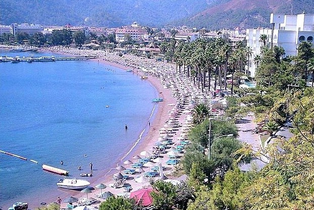
# İçmeler Beach (İçmeler Plajı) — Scenic Resort and Clear Bay in Marmaris
İçmeler Beach is a premium sandypebble coastline located 8 km from Marmaris, famous for its calm sea, pineclad mountain backdrop, and rich amenities. Serving as a quieter, familyfriendly alternative to Marmaris' urban beach, this popular resort town offers complete infrastructure in a more upscale setting. Beach Features and the Coastal Promenade The beach at İçmeler is significantly wider than the central beach in Marmaris. The shore is covered with coarse golden sand mixed with fine pebbles, and the water is cleaner and more transparent due to its distance from the main harbor. The bay is framed on three sides by steep, pineforested mountains, which shield the shoreline from strong winds and high waves. A scenic canal flows through the center of the resort, adding a Europeanstyle charm. An 8 km seaside promenade connects İçmeler to Marmaris, passing through pine groves along the coast. It is a favorite path for walking, jogging, and cycling. The promenade is lined with boutique hotels, upscale restaurants serving international cuisine, cafes, and water sports stations offering parasailing, jetskiing, and paddleboarding. Practical Information Location: [Marmaris](/en/marmaris) district, southwestern edge of the bay (about 8 km from the center) Road: Asphalt (flat coastal road). Orangestriped dolmuşes (minibuses) run between Marmaris and İçmeler every 5–10 minutes. Alternatively, regular water taxis shuttle between the two harbors during the season. Infrastructure: Full amenities including showers, restrooms, changing cabins, and lifeguards. Sunbeds and umbrellas can be rented or are provided by beach clubs. Entrance: Free (the public beach area is free to access). Sunbeds are rented for a fee or offered free of charge if you order food or drinks at beachfront venues. Tip: For a spectacular panoramic view of the entire bay, stop by the viewpoint on the winding mountain road to Turunç. If you prefer a quieter swimming spot, head to the far right end of the beach closer to the cliffs and pine forest.
Read More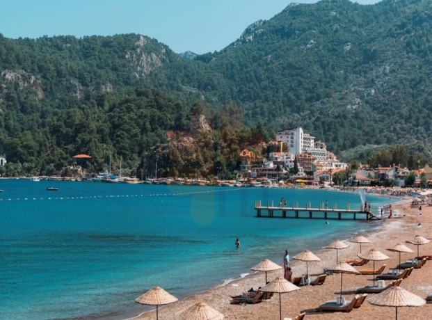
# Turunç Beach (Turunç Plajı) — Cozy Blue Flag Bay in Marmaris
Turunç Beach is a peaceful, Blue Flagcertified resort cove located 20 km from Marmaris, offering a relaxed fishing village charm and calm, clear waters. Surrounded by steep pinecovered mountains, this scenic destination retains the atmosphere of a traditional coastal village with lowrise buildings. Blue Flag Bay and Village Charm The crescentshaped beach of Turunç is composed of a mix of sand and fine pebbles. The bay is deeply indented into the coastline, which naturally protects it from opensea waves and winds, making the water exceptionally calm and suitable for family swimming. The prestigious Blue Flag award guarantees excellent water quality and environmental management. The village is renowned for its laidback and quiet atmosphere. You will not find highrise hotel blocks or noisy nightclubs here. The waterfront features a pleasant promenade lined with local fish restaurants, cafes, and souvenir shops. On Mondays, the local market in Turunç opens, offering fresh fruits, cheeses, and olive oils. Small boats depart regularly from the local harbor to neighboring Amos Bay and Kumlubük Beach. Practical Information Location: Bozburun Peninsula, [Marmaris](/en/marmaris) district, about 20 km southwest of the city center Road: Asphalt (winding, steep mountain road from Marmaris). Frequent dolmuşes (minibuses) connect Marmaris and Turunç (taking about 30–40 minutes). In the summer season, regular water taxis (shuttle boats) run between Marmaris harbor and Turunç pier. Infrastructure: Restrooms, showers, changing cabins, and lifeguard services are available. Sunbed and umbrella rentals are offered along the beach. Diving centers and water sports rental points are onsite. Entrance: Free (public access to the beach) Tip: Take a water taxi from Marmaris instead of driving. It is a scenic boat trip along the rocky Bozburun coastline that spares you from navigating the challenging, winding mountain pass.
Read More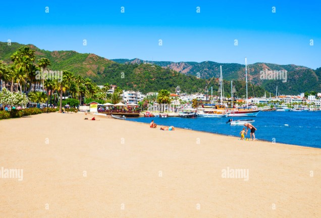
# Marmaris Urban Beach (Marmaris Halk Plajı) — The Epicenter of Resort Life
Marmaris Urban Beach is a long sandypebble coastline located in the heart of the city, famous for its free public access and lively promenade vibe. Stretching along the bustling Atatürk Boulevard, this beach attracts visitors with its ultimate accessibility, abundant entertainment, and proximity to major hotels. Rich Infrastructure and the Seaside Promenade The coastline of the urban beach is relatively narrow, consisting of a mix of dark sand and fine pebbles. The Bay of Marmaris is naturally sheltered from the open sea by Nimara Peninsula and local islands, keeping the water calm and wavefree with a gradual slope. The beach regularly receives the Blue Flag award for water quality and safety standards. The beach is divided into municipal (completely free) zones and private commercial sectors managed by seafront cafes and hotels. The municipal sections feature free public umbrellas, changing cabins, showers, and toilets maintained by the local municipality. An 8 km pedestrian promenade runs along the beach, linking central Marmaris to İçmeler. The promenade is lined with restaurants, bars, shops, and water sports stations offering jetskiing and parasailing. Practical Information Location: Center of [Marmaris](/en/marmaris), along Atatürk Boulevard (Atatürk Caddesi) Road: Paved city streets. Easy access on foot from most central hotels. All local dolmuşes (minibuses) connecting Siteler, İçmeler, and the main bus station stop close to the beach. Infrastructure: Free municipal restrooms, showers, changing cabins, and lifeguards. Sunbeds can be rented, and free public umbrellas are set up in the municipal zones. Water sports centers are available. Entrance: Free (no entrance fee, open public access 24/7) Tip: To save money on sunbed rentals, head to the free municipal section (near the Atatürk statue), where you can spread your towel under public umbrellas. For a cleaner and slightly quieter swim within the city limits, walk towards the Siteler district, where the beach is wider.
Read More